First Alert Forecast: Larger surf this Friday plus a front and instability to come
First Alerts as heavy pockets of sporadic downpours for the eastern end of the state by Friday
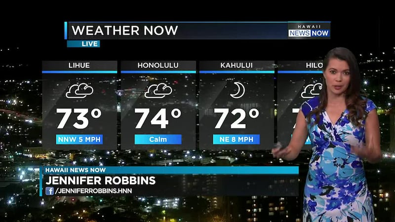
HONOLULU (HawaiiNewsNow) Very typical stable trade wind pattern remains established through today. It will be nice and refreshing as temperatures drop into the 60s at night into the early morning. Get ready for some nice cuddle and blanket weather if you are sensitive to cooler overnight lows. Plus VOG will be confined to Hawaii Island tomorrow with the recent reawakening of fountains over Kilauea.
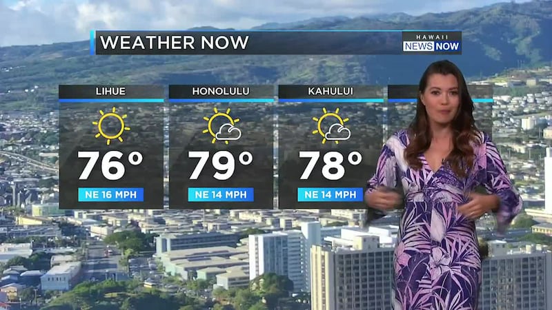
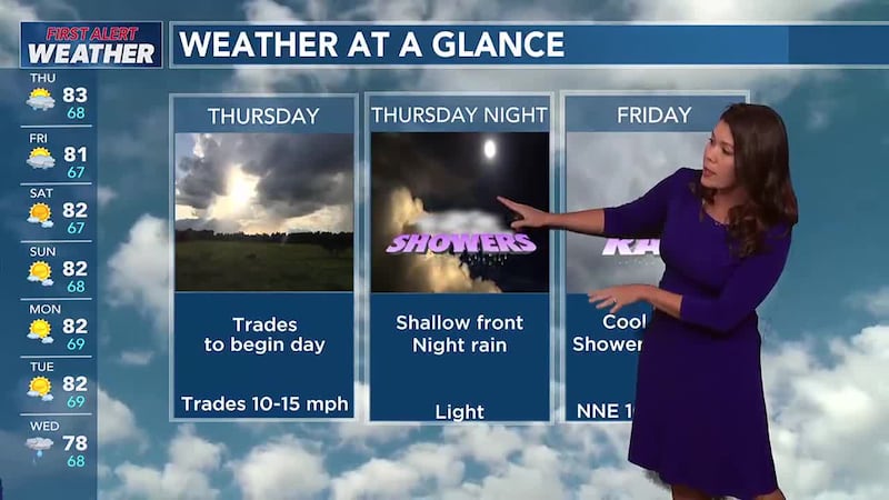
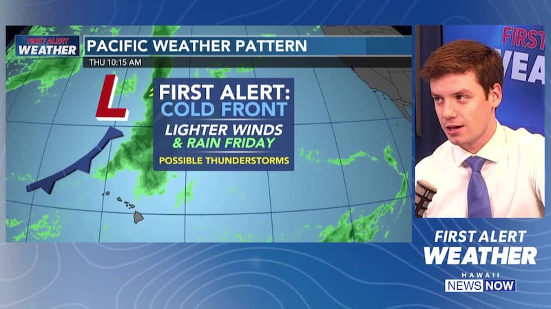
A land and sea breeze pattern with pockets of interior afternoon showers is expected for Thursday. Friday into Saturday represents a transition period to noticeably cooler weather as additional upper energy digs southward over the islands. Meaningful forcing remains largely north and east of the area during this time as ridging remains firmly in control. This wave will, however, force a shallow cold front through the area late Friday through Saturday. The inversion remains stout for the duration of the frontal passage limiting rainfall potential. The exception may be the high elevations of the Big Island and potentially Maui where a brief window for thunderstorms will exist Friday into Friday night. The front itself will hit with a brief round of shallow showers followed by winds veering to the northwest Friday night and eventually transitioning to breezy north-northeasterly trades by late Saturday.
This weekend will be characterized by dry weather and dewpoints falling through the 60s into the 50s bringing a seasonable chill to air. Trades persist through this time with strong post-frontal ridging bringing very high stability and significantly reducing shower coverage and intensity.
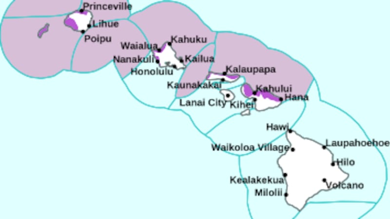
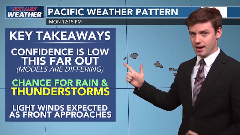
This will be another waiting game as potential pop-up storms will develop near the islands and may rush over the islands if the ingredients come together by the end of the week. If the models continue to hold, we will be calling a FAWD for Maui County and Hawaii Island as the front passes and then the upper-level disturbance -- trough-- brings some instability over Maui and Hawaii Island for FRIDAY - starting late morning into Saturday AM. It will be hit or miss heavy showers on Friday for the eastern end of the state but as early as Thursday night Kauai and Oahu could see an uptick in showers along a weak front itself creating showery conditions. The upper-level dynamics looks most significant just north of the islands with the upper-level disturbance just to our north. We could see some pop-up showers due to lighter winds and heavy pockets of hit or miss showers for all of the islands on Friday. Models suggest the most significant instability remains over the ocean to the north but along a converging wind on Friday, Maui and Hawaii Island may see more activity compared to the rest of the islands. We will continue to analyze the models calling a FAWD for Maui County and Hawaii Island mauka neighborhoods on Friday but wanted to give you a heads up as we sort through the details of the models. It highly depends on the ingredients of instability, which right now appear to stay just to our north over open waters.
Gentle to locally breezy trades will gradually weaken by Wednesday. Trade showers are expected to diminish overall as well, though some showers could linger for windward Big Island into Wednesday night. A relatively weak and disorganized cold front will push down the chain later Thursday into Friday. Unstable air associated with the front should help to enhance showers during this period, with a small chance for a couple rumbles of thunder in a couple spots as well. More stable and dry air should gradually fill in behind the front on a rather cool northerly flow, which will eventually turn to trades over the holiday weekend.
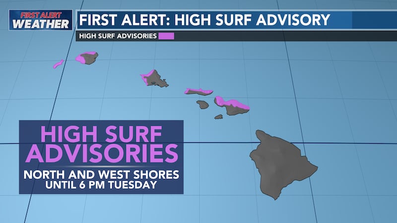
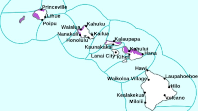
Let’s talk surf: The current moderate long-period northwest swell peaked this morning and is on the decline. Latest surf observations and buoy reports indicate both the surf and combined seas have dropped below advisory levels and will continue to lower over the next couple of days. A large, long-period northwest swell is expected to build Friday into Saturday with warning-level surf possible. A medium- period northwest swell is forecast to fill in during the first half of next week, keeping surf heights elevated over the remainder of the forecast period.
Surf along south facing shores will remain very small through Wednesday. A moderate long-period south swell is expected to fill-in Thursday, peak Friday near advisory levels, then slowly ease over the weekend. Surf long east facing shores will slowly decline through the end of the week. A small north swell could potentially elevate surf along exposed shorelines Wednesday and Thursday.
Wishing you and your family a very nice evening! Here is to 2025!
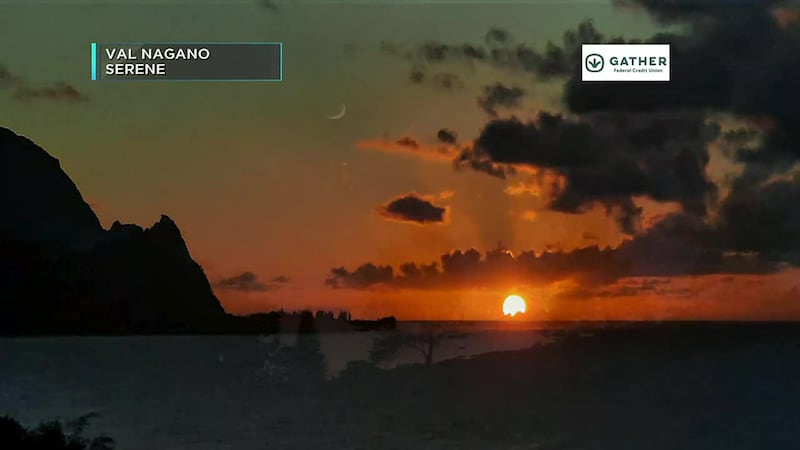
WISHING YOU BLUE SKIES AND MUCH ALOHA.
Chief Meteorologist Jennifer Robbins has Hawaii’s most accurate First Alert Forecast every weeknight at 5, 5:30, 6, 9 and 10. Get weather updates every ten minutes on HNN Sunrise, weekdays with Guy Hagi and weekends with Billy V. Meteorologist Drew Davis has your forecasts on This is Now at noon, First at Four and Hawaii News Now at 6:30. And join Ben Gutierrez weekend evenings.
Copyright 2022 Hawaii News Now. All rights reserved.