First Alert Forecast: Heavy rain possible for the Big Island today, breezy winds expected through tomorrow
HONOLULU (HawaiiNewsNow) - The potential for heavy showers and isolated thunderstorms will exist overnight into Monday near or over the Big Island, driven by increasing moisture and an upper disturbance lifting north over the eastern end of the state.
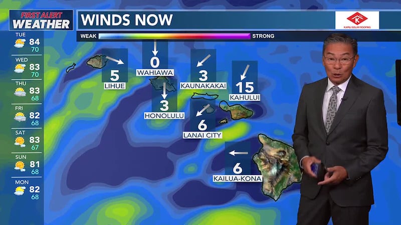
Across the rest of the state, a typical trade wind pattern will persist through the first half of the week, with showers favoring windward and mauka areas.
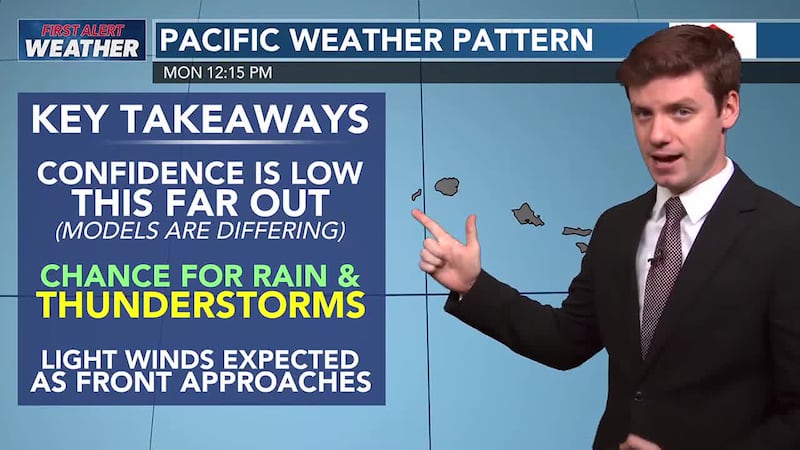
However, trades will weaken in the latter half of the week as an upper disturbance and a cold front approach, possibly leading to more widespread rain and thunderstorms.
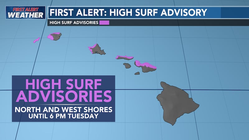
A moderate to large northwest swell is expected to fill in through the day on Monday.
High Surf Advisory (HSA) level conditions are expected as the swell peaks Monday evening.
An even larger, long- period northwest swell that could bring High Surf Warning level conditions for most north and west facing shores is expected Friday.

Copyright 2025 Hawaii News Now. All rights reserved.